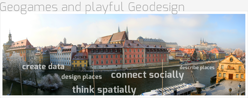
Location-based games introduce an element that is missing in interactive console games, namely locomotion in outdoor environments such as an urban neighborhood or a natural park. These games are particularly interesting for educational projects because they not only connect the players socially but also connect them with the geographic environment. Starting in 2004, the Geogames team at the University of Bamberg, Germany, has studied and developed location-based games which are used in different educational scenarios (e.g. river ecology, cultural heritage). The “Geogames and Playful Geodesign” project is sponsored by ESRI. It draws on our teams’s experience to develop prototypes of games and design tools based on ArcGIS technology for two novel application scenarios:
Location-based games as a medium for education in spatial thinking.
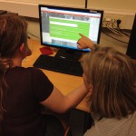
Different stages of involvement with GI are supported which, at the entry level, amount to playing a game in an outdoor environment. At more advanced levels, students create geodata with a game (VGI, volunteered geographic information), or relocate a game from one place to another, a task that implies engaging in spatial analysis. In terms of software, the project’s outcome consists of a collection of location-based game prototypes and a design tool. The collection includes a simple demo game which can be played almost everywhere, an ecological simulation game, and a VGI game. The design tool supports the spatial analysis needed for relocating a game. Note that Geogames not only provide a medium for education in spatial thinking, but also challenge and exercise physical fitness. Especially the demo game can be played as a fitness game.
Playful activities as a medium for problem-solving in Geodesign.
The project explores a novel approach to Geodesign which uses a location-based game to support the spatial design process. Exploiting the connection between the reuse of a spatial design and the relocation of a spatial game, the Geogames team devises and implements a Geodesign game. Such a game should permit the players to develop new perspectives on the spatial environment. The Geodesign application scenario breaks new ground for location-based game research. While the technological objectives (game design and implementation) bear no risk, we cannot state today to what extent such a game will improve the design process. It is only by trying that we will know.
Are you interested in Geogames?
We are looking for people interested in using our Geogames or in assisting to create new ones. Please send a short notice to and we will keep you informed about our software releases and Geogames events.
After the success of our events in years past, the Geogames team of the University of Bamberg is proud to be able to host a “Geogames and Geoplay” workshop at AGILE 2016 once more. We are looking forward to introducing you to the topic of geogames, as well as the inspiring discussions we hope to have.
Participants are invited to either submit a short paper (max. 3000 words) about original ongoing research in Geogames or a position paper (max. 1500 words) describing a game demo or an application scenario. Short paper submissions will be reviewed and selected for a presentation during the workshop. The authors of selected position papers will be invited to participate in the panel discussion.
The topics of the workshop include, but are not limited to:
- Thematic focus 2016: Gamifying Geoinformation Crowdsourcing
- Experience reports about the design and development of Geogames
- GI technologies in video games and location-based games
- Playful approaches to Geodesign
- Data collection games, VGI games, human computation games
- Simulation and AR games
- Educational Geogames
For more information on the workshop visit the workshop website.
We are happy to announce that the Geogames team of the University of Bamberg will offer a second workshop on the topic of “Geogames and Geoplay” at AGILE 2015. The workshop will be a mixture of presentations, hands-on demonstration, working-groups, and of course: discussions.
The topics of the workshop include, but are not limited to:
- Experience reports about the design and development of Geogames
- GI technologies in video games and location-based games
- Simulation and AR games
- Data collection games, VGI games, human computation games
- Playful approaches to Geodesign
- Educational / Serious Geogames
For more information on the workshop visit the workshop website.
You are interested in Geogames, but you do not know, where to start?
Just for the case you want to take a quick glance on the opportunities, Geogames provide, we compiled a short product information for your convenience.
Geogames product information
Two Geogames events took place (rather space) in summer 2014 so far:
– Peter Kiefer (ETH Zürich) presented at the ifgi Summer School 2014 on Gamyfing Spatial Collaboration using our CityPoker Designer and staging a game.
– Barbara Feulner (Augsburg University) staged a Neocartographer event with school kids evaluating urban public spaces in Augsburg
Olga Yanenko, member of the Geogames team, gave a lightning talk in this year’s DevSummit taking place March 10-13 at the Palm Springs Convention Center.
Have a look at her prezi!
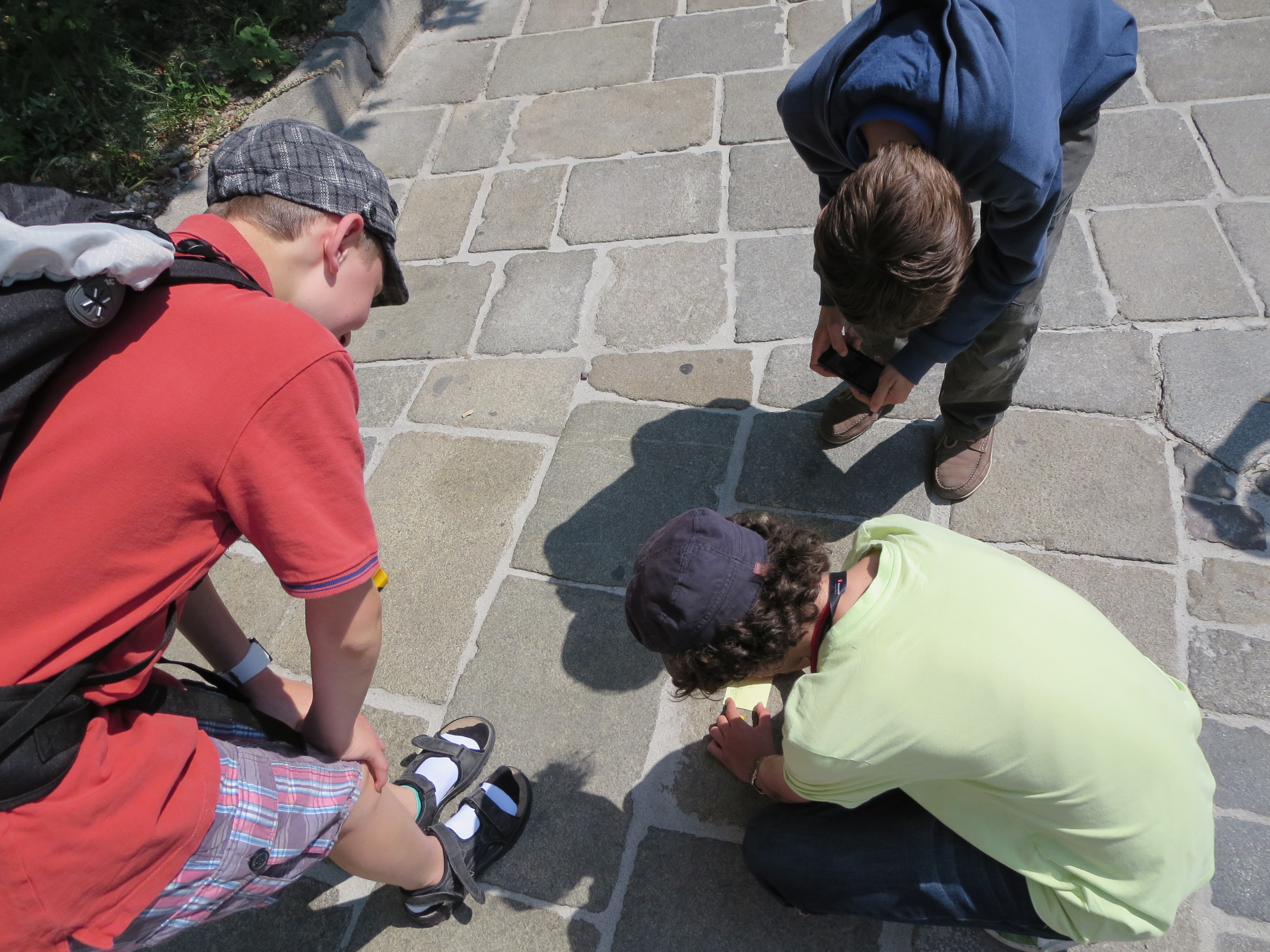
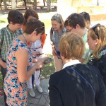
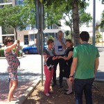
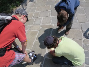
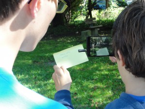
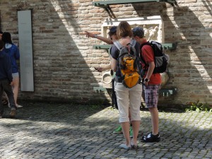
The Geogames team at the University of Bamberg was organizing a workshop on “Geogames and Geoplay” at this year’s AGILE conference in Castellón, Spain. After an introduction by Christoph Schlieder and the presentation of seven short papers the participants had the chance to play CityPoker, a mobile Geogame, as well as a Green Revolution desktop Geogame. A discussion about topics for a research agenda in this area was also part of the workshop.
For more information on the workshop visit the workshop website.
Here are some impressions:
Where you think you are, is not where you might end up playing this game! Guesstimate is a casual game that uitilizes algorithms typically used for GPS positioning and provides you a random exploration experience of your city.
Knowing about your distance to predefined locations around you allows you to compute your current position. Of course, this task gets more difficult by 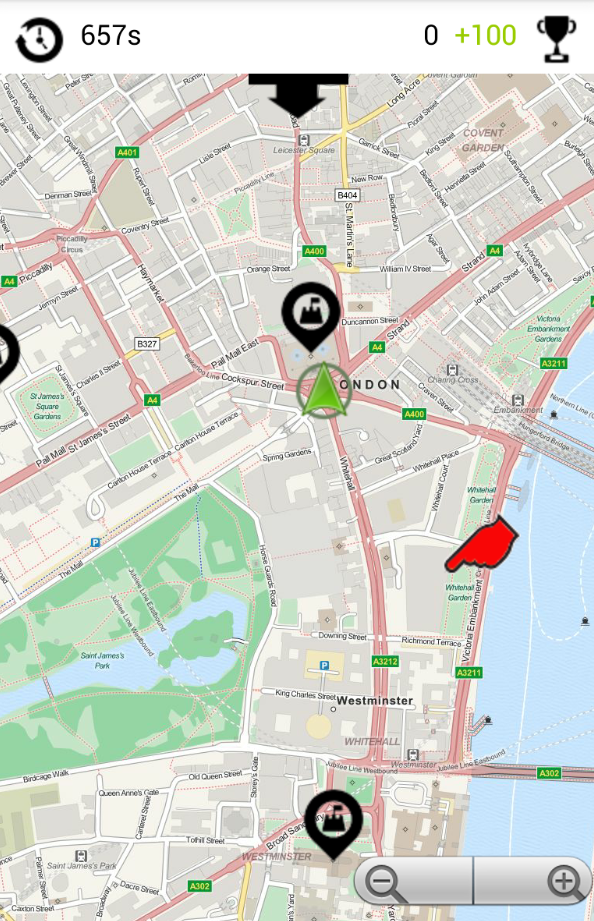 measurement errors. Guesstimate illustrates the impact of such errors by handing the job of delivering reliable distance measurements over to you: How far is it from your current position to e.g. Big Ben, Westminster Abbey or Tower Bridge? From your guesses, Guesstimate derives a geocoordinate where you would be, if your estimations were correct. Before the next round starts, you have to move to that place as a penalty – the better you guess, the less you walk…
Give it a try (just download the file on your Android device and tap once to install):
http://www.geogames-team.org/files/Guesstimate.apk
Got noone staging a game for you? Design your own gameboard with only a few taps on your mobile:
http://www.geogames-team.org/guesstimate/editor/
Thanks again to ESRI for making this possible.
As an outcome of the Geogames and Playful Geodesign project funded by ESRI, a new game is available. Equilibrium tells you a lesson about population dynamics.
Have a look at the demo video:
Interested? Drop us a line: geogames[at]uni-bamberg.de
As an additionel outcome of the Geogames and Playful Geodesign project funded by ESRI, a designer tool for the CityPoker Geogame ist now available online:
www.geogames-team.org/designer/
- Choose your town
- Arrange a game board – the designer assists you!
- Print your game board
- Play!
Just give it a try! A brief introduction to the game is provided within the editor. All you need to play is the possibility to send messages from one team to the other!
A more precise workflow of the tool and its use cases in classes on geography at school will be published until August 2014 in the in the most widely read journal for geography teachers in Germany, Praxis Geography.
Got you? Drop us a line: geogames[at]uni-bamberg.de